More media 1
Description
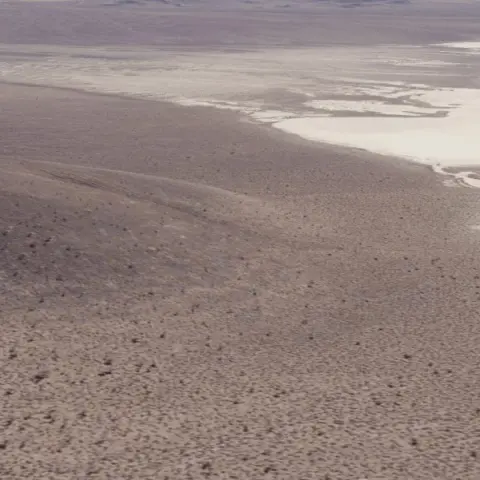
After watching the S4 Bob Lazar documentary, I got curious and decided to go on Google Earth to check out those tire tracks they showed at Papoose Lake.
I started scrolling through the historical imagery for those exact coordinates, and I noticed something interesting. The exact same tire tracks you see in the recent satellite views show up in every single year all the way back to 2006.
I'm genuinely just curious—why are these still here? I would have expected tire tracks to be completely washed away, blown over by wind, or covered up by the elements at this point. It’s been over 20 years.
They might actually be even older than 2006, to be honest. It's just that any satellite imagery from before then gets way too blurry to see anything clearly, so 2006 is the furthest back I can confirm.
Does anyone know how desert environments or dry lake beds work with this kind of stuff? Is it normal for ground scars to just freeze in time for decades without washing away?
Coordinates:
37°06'48.88"N 115°50'55.83"W
Comments 0
Sign in to join the discussion.
What do you think it is?
Sign in to vote. 0 votes.
👥 Other witnesses
🙋 I saw this tooSaw it too? Add your account — independent witnesses are the best evidence.
🔔 Alerts for sightings like this
Source
u/Pinktoe_ on r/UFOs
Citations
https://www.reddit.com/r/UFOs/comments/1sh3zqc/i_checked_those_tire_t…
Similar sightings described alike
 Drone like UFO's/UAP's on Google Earth. 23 cases so far...Argentina
 Planetary consciousness, UFO’s, Artificial Intelligence and the „Abyss from there is no return“
 Bob Lazar's S4 account vs photography/satellite
 Lake Minchumina and the Underground Pyramid in Alaska, I think i miiiight have found the location!Alaska
 All this talk about technology transfer to the private sector and speculations about mysterious finds in Antarctica look pretty interesting now that I'm investigating the history of Antarctic…
 UFO crash, Salta, Argentina + U.S. presence. 8/17/1995Salta · 1995
 MH370 Airliner videos part III: The rabbit hole goes deeper than we thought2014
 My observation - finally after 20 years I decided to present my story to a wider audience - UPDATE and some important topic
No comments yet. Start the conversation.