More media 1
Show the original Reddit post
Description
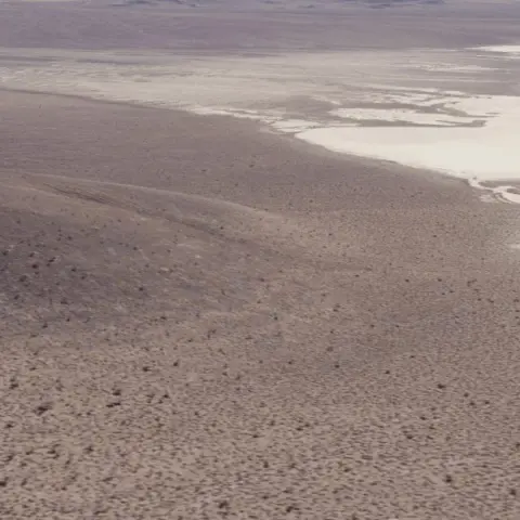
In an exchange with researcher Tom Mahood, Gene Huff answered the following question regarding the positioning of the facility in the landscape:
https://otherhand.org/home-page/area-51-and-other-strange-places/blue… (https://otherhand.org/home-page/area-51-and-other-strange-places/blue…)
Mahood: *"Do I understand you correctly that the facility passed completely through a ridge, with the hangars on one side and the “entrance” on the other?"*
Huff: *“Through a ridge” might be somewhat misleading. I don’t think Bob was enough places in the facility to state that it passed through an entire ridge. However, yes, it did pass through the corner of a jag/ridge in the mountain. The hangars were on one side of the corner and the pedestrian entrances were around the corner from that.*
This description aligns with annotated satellite images made by Bob Lazar and Jon Farhat circa 2001 showing the outline and layout of the S4 facility:
https://i.imgur.com/WW9q3lE.jpeg (https://i.imgur.com/WW9q3lE.jpeg)
It also aligns with digital images they created to show the layout of S4, the hangar, and its distance from the entrance of the facility.
https://i.imgur.com/hyfT9mv.jpeg (https://i.imgur.com/hyfT9mv.jpeg)
This image is from S4 documentary, showing the Project Gravitaur recreation of the edge of the hangars and the ridge the facility passes through.
https://i.imgur.com/QR7fVIY.png (https://i.imgur.com/QR7fVIY.png)
Comments 0
Sign in to join the discussion.
What do you think it is?
Sign in to vote. 0 votes.
👥 Other witnesses
🙋 I saw this tooSaw it too? Add your account — independent witnesses are the best evidence.
🔔 Alerts for sightings like this
Source
u/SignalsIntelligence on r/UFOs
Citations
https://www.reddit.com/r/UFOs/comments/1sfzjkw/some_additional_inform…
Similar sightings described alike
 The Billy Meier UFO and Bob Lazar's UFO are almost identical in appearance. Lazar addresses this by saying Meier must have captured a real UFO in his first photos and then faked photos after that to…1975
 September 1st, 1969: Berkshire UFO AnniversaryGreat Barrington · 2021
 Holy Mylar Balloon, Batman! What We Know About the Purported "Batman Balloon" Photo2019
 All this talk about technology transfer to the private sector and speculations about mysterious finds in Antarctica look pretty interesting now that I'm investigating the history of Antarctic…
 "2027": Is there reasoning for the "2027" date being relevant to disclosure based strictly upon U.S. classification laws? (tl;dr: yes, potentially)2024
 Bob Lazar's S4 account vs photography/satellite
 The Golden-Haired, Bare-Skinned Alien of 1897Springfield
 Planetary consciousness, UFO’s, Artificial Intelligence and the „Abyss from there is no return“
No comments yet. Start the conversation.