Map
Where each report was made. Tap a pin to open it.
Over time
Reports per day — the busiest was 8 Apr 2026 with 2. Hover or tap a bar for its count.
Every report (7)
Friday 3 April 2026 · 1 report
-
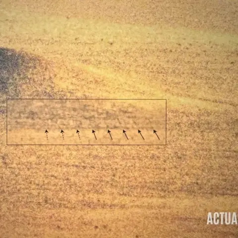 A photo of S4 has been released, proving that Bob Lazar was correct about the existence of a facility with 9 hangar doors at Papoose Lake
📍 Papoose Lake, Nevada, USA
Credit goes to Scott Michell (@realwiseburger) for finding the photo
Saturday 4 April 2026 · 1 report
-
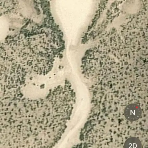 These are the tread marks supposedly leading to S4 (Bob Lazar claims)
📍 Homey Airport, Nevada, USA
This was mentioned on Joe Rogan’s latest podcast with Bob and Luigi. The tread marks are still visible on google earth though other structures have been edited out. And …
Sunday 5 April 2026 · 1 report
-
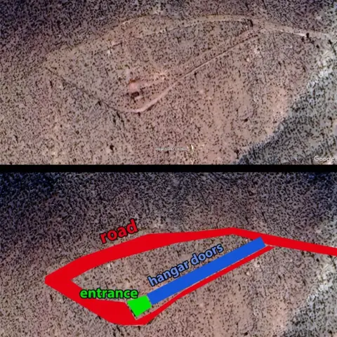 Hear me out!
📍 Area 51, Nevada, United States
1. Alleged S4 location near area 51. 2. Alleged S4 photo from the recent Bob Lazar documentary. 3. Bob Lazar illustration of the site. 4. Same hill from ground level. 5.…
Wednesday 8 April 2026 · 2 reports
-
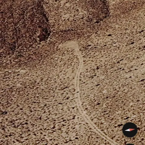 Sat images of papoose lake area
📍 Papoose Lake, Nevada, USA
I was watching S4, the Bob Lazar story, and there is a part where they show essentially his route on a bus around the lake and how the image of the S4 region around Papo…
-
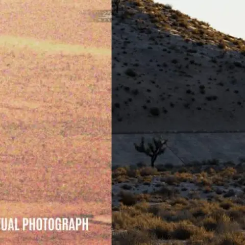 Some additional information to consider when comparing the photo of Papoose Lake shown in "S4: The Bob Lazar Story" with prior descriptions and depictions of S4 given by Bob Lazar and his close…
📍 Papoose Lake, Nevada, USA
In an exchange with researcher Tom Mahood, Gene Huff answered the following question regarding the positioning of the facility in the landscape: https://otherhand.org/ho…
Thursday 9 April 2026 · 1 report
-
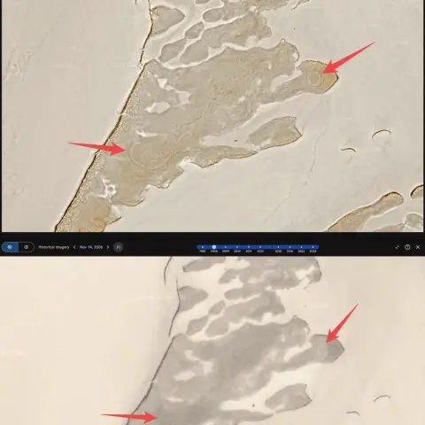 I checked those tire tracks shown in the S4 Bob Lazar documentary on Google Earth...they show up every year all the way back to 2006. Why haven't they washed away?
📍 Papoose Lake, Nevada, USA
After watching the S4 Bob Lazar documentary, I got curious and decided to go on Google Earth to check out those tire tracks they showed at Papoose Lake. I started scroll…
Friday 10 April 2026 · 1 report
-
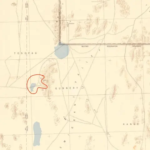 1942 Map Shows Road and Mine Into Papoose Range Near S4
📍 Papoose Lake / Groom Lake area (S4), Emigrant Valley, Nevada, USA
I came across what I believe *might* be the map Luigi Venditelli referenced on the Rogan podcast (https://www.youtube.com/watch?v=Lb\_1d68vx-g&t=9613s (https://www.youtu…
Seen it too? Add your sighting with the date and place, and it will join this wave when the site next looks for waves.
More waves & bursts

 🌊 WaveLight wave around United States — May–June 2026
 ⚡ BurstLight sightings around New York — 27–28 June 2026
 🌊 WaveUFO wave around Roswell, New Mexico — July 2026
 ⚡ BurstUFO sightings around Miami, Florida — 1–2 January 2026
 ⚡ BurstUFO sightings around Florida — 6–7 July 2026
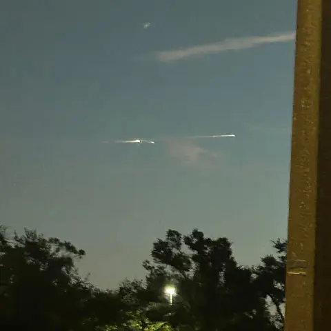
 ⚡ BurstLight sightings around Florida — 8–9 November 2025
Explore more
What’s that light?Identify a light in the sky tonight — planets, satellites, rockets, planesStarlink in the skyWhy a line of lights looks like a UFO, and when to see oneUAP explainedWhat UAP means — AARO, reports, laws, hearings and whistleblowersUFO newsThe latest UFO and UAP news, official releases and developmentsUFO videos & documentariesThe famous UFO videos and the documentaries, films and books about themArea 51The Nevada base at the centre of UFO lore — history, claims and sightings nearbySkinwalker RanchThe Utah ranch studied by government-funded researchers — history and claimsOfficial UFO filesGovernment UFO files and releasesUAP EncyclopediaEvery case, person, program and place, with sourcesUAP TimelineDated events in UFO history from 1947, each with sourcesSightings mapEvery sighting with a place, on one map